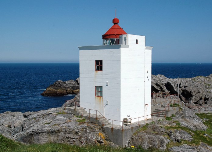
Ulla Lighthouse

Møre og Romsdal
|
|
| Location | Haramsøya Haram Municipality Norway |
|---|---|
| Coordinates | Lua error in package.lua at line 80: module 'strict' not found. |
| Year first lit | 1950 (current) |
| Automated | 1975 |
| Construction | concrete tower |
| Tower shape | square parallelepiped tower with balcony and lantern |
| Height | 10.5 metres (34 ft) |
| Focal height | 21.5 metres (71 ft) |
| Range | 14.2 nautical miles (26.3 km) |
| Characteristic | Oc (2) WRG 10s. |
| Admiralty number | L0872 |
| NGA number | 6260 |
| ARLHS number | NOR-259 |
| Norway number | NF-3450 |
| Managing agent | Ullafyrets Venner |
Ulla Lighthouse (Norwegian: Ulla fyr) is a lighthouse just off the north end of the island of Haramsøya in Haram Municipality, Møre og Romsdal county, Norway. The lighthouse sits on the very small island of Ulla, about 1.5 kilometres (0.93 mi) northwest of the Ullasund Bridge. The light at the top of the 10-metre (33 ft) tall tower emits a white, red or green light, depending on direction, occulting twice every 10 seconds. The light sits at an elevation of 22 metres (72 ft) above sea level.[1]
In October 1944, the lighthouse and the surrounding buildings were attacked by allied airplanes. The lighthouse was badly destroyed, and not rebuilt until after the war in 1950.
The lighthouse is still in operation, and is protected by the Norwegian government as an historical landmark. The Norwegian Coastal Administration owns the surrounding buildings, and the old station is available for hire.[2]
See also
<templatestyles src="Stack/styles.css"/>
References
External links
- Ulla fyr
- Norsk Fyrhistorisk Forening (Norwegian)
- Picture of Ulla Lighthouse leuchtturmseiten.de
<templatestyles src="Asbox/styles.css"></templatestyles>
|
This Norwegian lighthouse-related article is a stub. You can help Wikipedia by expanding it. |
<templatestyles src="Asbox/styles.css"></templatestyles>
|
This Møre og Romsdal location article is a stub. You can help Wikipedia by expanding it. |